
Everything in the web beta, with screenshots
The web app is a research platform: a MapLibre map with more than thirty layers, the models, rankings and tools below, organised in a left-hand Filters & layers panel with a Simple and a Full view. Screenshots are from the current beta and will change as it matures.
Terrain, models and mines on one canvas
- Basemaps: an outdoor street and topo basemap, satellite imagery, USGS shaded relief, our own 1 m LiDAR hillshade, USGS 3DEP relief nationwide and topographic contours.
- Models: Gravity, Hydraulic, Composite, Crevice and Gulch as pre-rendered 1 m rasters; the Flood line model; and on-demand model runs for an area you draw.
- Mines: USGS MRDS gold occurrences, clustered with deposit-type wedges, filterable by deposit class, development status and Pan Potential.
- Share and save: any view is a link; saved areas keep the whole layer, model and filter setup.
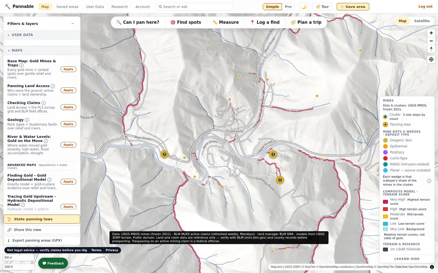
Ten curated maps, one click each
Applying a preset resets the map to a clean slate and lays out a complete, named recipe, so two people applying Checking Claims see the same thing.
- Base Map: Gold Mines & Traps: all mines, rankings and stream traps over gentle relief and rivers.
- Panning Land Access: adds active claims and land ownership.
- Checking Claims: adds the PLSS survey grid and BLM field offices.
- Geology: rock types and Quaternary faults.
- River & Water Levels: the Flood model, flood accumulation and drought.
- Advanced Maps: Finding Gold (Gravity), Tracing Gold Upstream (Hydraulic), Gold Trapped on Bedrock (Crevice), River and Water Models (Flood plus the River Reset Clock) and Hunting for Big Gold (Gulch).
The historical record, scored and ranked
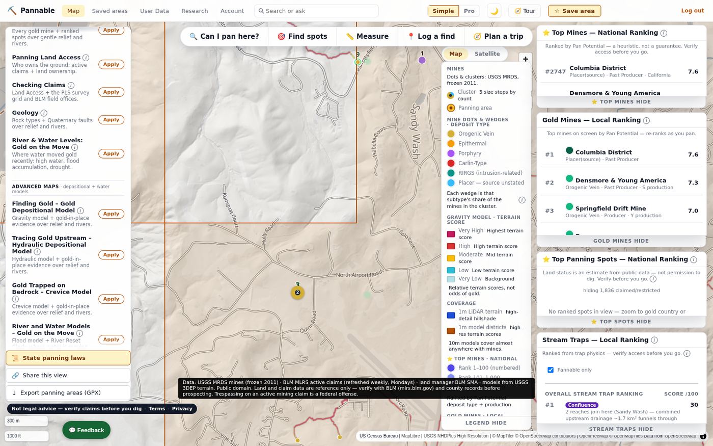
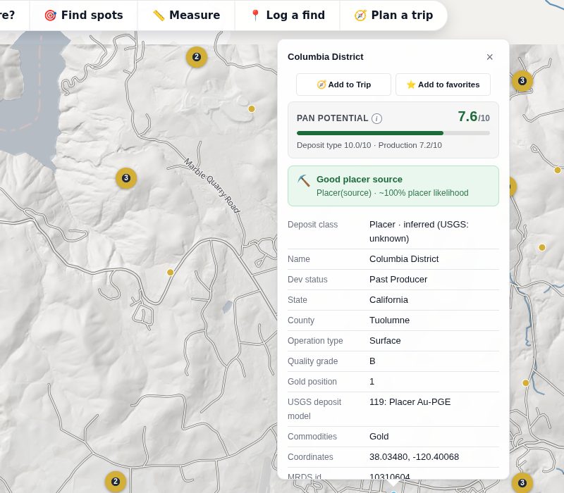
Every mine carries a Pan Potential score (0–10) built from its deposit type (how much placer gold that kind of source tends to shed) and its recorded production class. The detail card shows the score, the reasoning, and the USGS record it came from.
- Top Mines: the 5,000 highest-scoring mines nationally, numbered on the map.
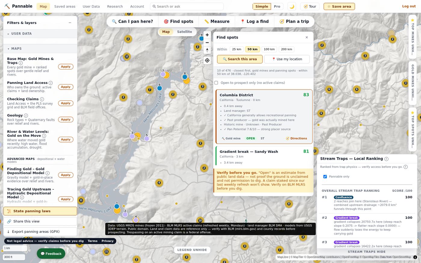
- Gold Mines: the top ten on screen, re-ranked as you pan.
- Promising panning spots (verify access): a fused ranking of historical evidence, gold-in-place evidence and trap physics, with a dated land-status snapshot for each spot. A research lead, not permission to dig.
- Stream Traps: confluences, gradient breaks and inside bends scored from the river network, each with a plain-English reason.
Rankings are heuristics built from public data, not guarantees.
Claims, ownership and one honest answer
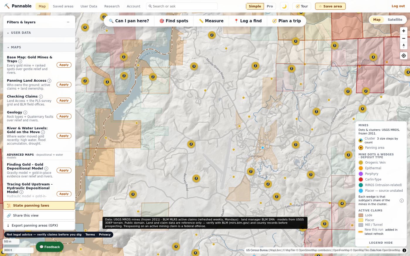
Active claims from BLM MLRS, scheduled to refresh weekly (the data date is always shown), drawn as lode, placer and mill-site polygons with a “new this run” highlight and a snapshot date. Land ownership from PAD-US and the BLM surface-management dataset. Wilderness, monuments, wilderness study areas, critical habitat and wild and scenic rivers as reference overlays. Private parcels from free state and county services where they publish them.
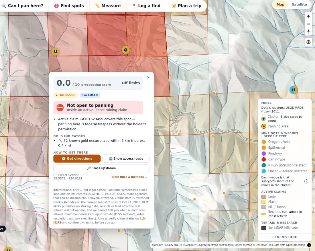
“Can I pan here?” fuses all of that with the state’s recreational-panning rules into a 0–10 prospecting score and a dated summary of what the public records show, with reasons, nearby gold indicators, directions, access roads and an upstream trace.
"Open" is an estimate from public land data — not proof the ground is unclaimed and not permission to dig. A claim staked since our last claims refresh won't show. Verify on BLM MLRS before you dig.
Find spots, measure, log, plan
- Find spots: ranked gold mines and panning spots within 25 to 200 km of a point or of your location, closest first, with an “open to prospect only” filter.
- Measure: distances and areas on the map.
- Log a find: your own gold log with location, gold size class, date and notes; import and export as CSV, Excel or GeoJSON.
- Plan a trip: collect mines and spots into a trip, check conditions and get directions.
- Your claims and trend lines: draw your own claim boundaries and trend lines, and run the models on an area you choose.
When is as important as where
Flood model
Rivers glow where live USGS gages are running high, with week, month and season windows. High water moves gold, and it is dangerous: stay out of swift or rising water and pan after flows drop.
Season phase
Each district is classified from snowpack and streamflow as pre-freshet, freshet, recession or baseflow, so you know whether to scout or dig.
River Reset Clock
Per reach: when did the last armor-breaking flow happen? Built from 44 years of National Water Model history and compared weekly against current conditions.
Conditions
Flood accumulation, the US Drought Monitor, live gage readings and NWS forecasts for the spot you are planning.
Research, geology and the field
Research library
Plain-English summaries of recreational prospecting rules for 14 states, linked from every verdict card, plus the explainers behind each model and layer.
Geology
USGS State Geologic Map Compilation by rock type or age, Quaternary faults mapped by age, gold-in-place evidence from stream-sediment geochemistry, and closed-claim density.
Access
USFS motor-vehicle roads, BLM roads and trails, BLM recreation sites and field offices, and the PLSS survey grid for reading a claim description.
Gold Panning (Photo) experimental
Photograph the creek bed in front of you and get up to five marked spots to test, with a 3D view of how water would run over it. Early, and it says so.
Simple and Full views
Simple shows the presets and the essentials; Full exposes every layer, opacity slider and filter.
Mobile app (in development)
Offline packs, GPS field mode, land and claim records at your feet and a find log. Not yet in the app stores.
Stay safe out there.
- Never enter abandoned mine shafts or adits. They can hold deadly air, hidden drops and unstable rock that can collapse without warning. Stay out, stay alive.
- Stay out of swift or high water. Flash floods can arrive with little warning. On Pannable’s high-water and flood layers, high water means danger, not opportunity — wait for flows to drop.
- Remote travel: tell someone where you’re going and when you’ll be back, carry plenty of water, and expect no cell coverage.
Model output is relative terrain scores for decision support, not a measurement of gold. Verify before you dig: confirm current claim status on BLM MLRS and land-use rules with the managing office (BLM/USFS/state) at the actual site, every time. Prospecting on an active mining claim without the claimant's permission can expose you to civil liability and other penalties. See the model explainer.